The length of the Gylderau

Finally a nice day, this is the weather that I have been waiting for.
I planned this walk a few weeks ago and was waiting on good weather to do it. It's not one I had done before so I really wanted to have good visibility, especially as there should be a spectacular view of the Carneddau and Glyderau mountain ranges.
It's also nice not being wet and blown about all day.
As for my low-level walk the other day it starts in the public car park just being the Joe Brown shop in Capel Curig. I knew this would be quite a long day, I wanted to enjoy the views and take my time but I was conscious of the amount of light available at this time of year.
Also, as this was a point-to-point route I had to get back to my car somehow, more on that later.
The route started uphill pretty much from the start, the 3 days of hard hiking before this came in as good practice.

The beautiful tones of the heather
There was not much of a discernible path so it was just a matter of following what I could see and following a rough bearing and just aiming for the highest point.
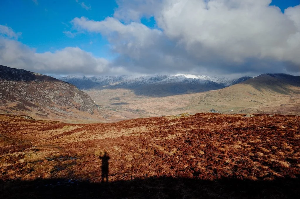
Looking over the snow covered Carneddau
The first hour was pretty wet underfoot, so far I’d been walking in my Salomon hiking shoes, but I’d gotten pretty wet in these for the first day. I’d decided to treat myself to a new pair of Salomon mid-length lightweight boots yesterday as I had a suspicion that it could be a bit boggy with all of the rain.
This turned out to be a good decision, I know it's not ideal to wear a new set of boots on a long walk but they were super comfy and had that bit better coverage when trudging through the bogs.
I soon started to see the aftermath of the snow that I’d been in yesterday.

A dusting of snow on the way to Galt yr Ogof
At first, it was more of a light dusting but then got quite scrunchy underfoot.

I love the sound of scrunching through virgin snow
As I was approaching the summit of Galt yr Ogor the stunning Tryfan loomed into view, along with the length of the Carneddau mountain range.

Tryfan just coming into view.

Tryfan just coming into view.
I would have liked to have added Tryfan onto the day but I felt at this time of the year it would have been a bit too much, maybe another time in the summer.

The stunning Tryfan on the way up to Glyder Fach
The snow soon became a lot deeper as I headed up to Glyder Fach, I could see from the lack of other footprints that I was the first person up here that morning.
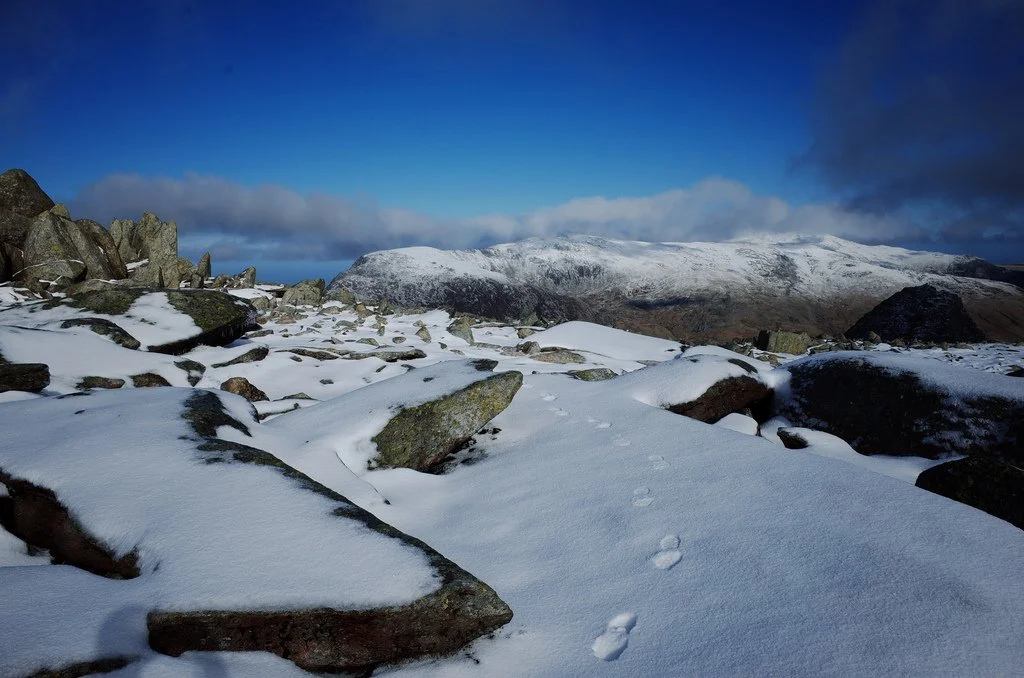
Virgin snow on Glyder Fach.

Windswept

Top of Glyder Fach

The famous Cantilever on Glyder Fach

The top of Glyder Fach
I decided to head up to the top of Castel Y Gwent, loosely translated as "Castle of the Wind". This was a bad idea as the rocks were covered in verglass, I didn’t notice too much on the way up but it made getting off the big boulders very treacherous.

Icicles on the top of Gyder Fach
I then came off Glyder Fach down to the bwlch and then up to Glyder Fawr, at this point the cloud came in and visibility got pretty poor, the temperature appeared to drop quite a bit as well, although that was most probably due to wind chill.

Looking back to Glyder Fach
I took a few atmospheric shots on the top, The cloud cleared at this point which meant I could get a few shots of Snowdon as well.

At the top of Glyder Fawr, the cloud cover started to come down at this point.

At the top of Glyder Fawr, the cloud cover started to come down at this point.

It was pretty cold on the tops

Snowdon from Glyder Fawr

Me with Snowdon in the backgound.
Then down off the top to a well-earned lunch stop and Llyn y Cwn. I’d stopped in the same place a few years ago with my son on the way up to Tryfan from Y Garn.

Lunch stop, at Llyn y Cwn between Glyder Fawr and Y Garn
The going from here was a bit easier going as there were fairly well-defined paths and not much rock, it's still pretty steep though.

Pen Yr Ole Wen.
I was rewarded with a stunning view of the Carneddau over the other side of Ogwen valley and some of the routes that I’d been on.

I didn't see many people on the day, these two were making their way to the top of Y Garn.
From the top of Y Garn it was a steady downhill to the town of Bethesda.

Pen Yr Ole Wen and the rest of the Carneddau range.

Some of the Glyderau range with the beautiful Tryfan top middle.

An atmospheric look back at some of the route.
Normally when I’m on my own I do circular routes, it's a bit more of a challenge to start and end in the same place but at least it means that your car is there at the end of the walk.

Some of the route taken today.
This one would be A to B so it made getting back a bit trickier. The plan was to get the bus back to Capel Curig, unfortunately, at this time of the year, they only go every 2 hours. The fallback was to get a taxi if the wait was too long. Luckily, I’d judged it pretty well as I only had to wait 20 minutes, which gave me time to pop into the Tesco local to a choccy bar and a drink.
Somehow coming back on the bus felt more “real”. It also allowed me to appreciate the view of the route I’d just done and also how far it was.

Finished! On the way back to the car.
The route and profile are below.


Quite an uphill start.